Page 1 Page 2 Page 3 Page 4
Page 5 Page 6
(click on photo for larger, sharper image)
These trails are located with the Hawes Trail system bounded very roughly by Bush Highway to the west and Las Sendas to the south. There is an Upper
and Lower section of the trail. The lower trail goes back to a main trail while the more difficult upper trail goes to the other side of the mountain
looking towards Four Peaks.
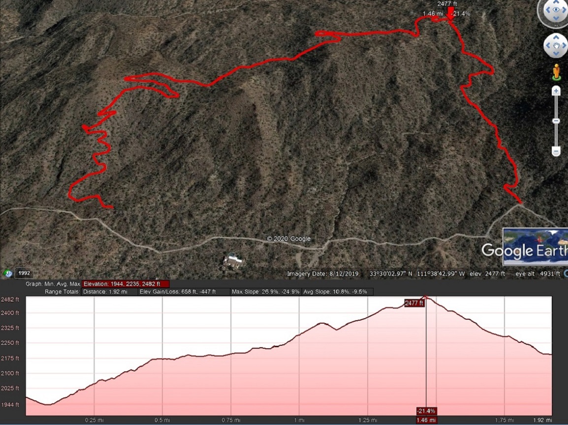
This chart of the Lower Gidro shows that the trail was hiked from the left side of the map up to the red arrow. The arrow is where the two trail
heads meet. The segment going down from there on the right side is not part of Gidro, but the steep trail away from it.